First (and Last) Hurricane of the Atlantic Season
The Setup
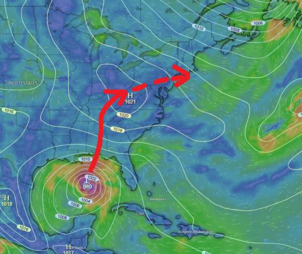
source: windy.com
Hurricane Isaias has officially formed and is expected to strengthen into a major hurricane with significant storm surge and strong gusts expected for the gulf states. Our region will likely receive some coastal flooding due to the larger high tide values expected this weekend, but it won’t be as bad as the Nor’easter we had late September.
The current forecast cone has the storm tracking north through the panhandle/Alabama and then eventually moving more NE around TN/KY and exiting over our region. This track has the remnants interacting with high pressure over the west Atlantic, creating a south/southeast wind fetch aimed well at our region. See the wind chart below:
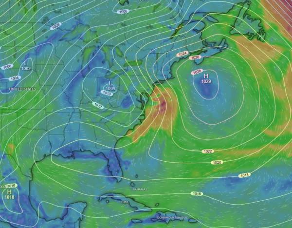
source: windy.com
Buoy numbers are likely to be in the 6-8ft at 8 second range with a swell angle around 165 degrees. This is a good swell angle for our region, but the wind forecast is still up in the air. Currently, winds are expected to switch north before going offshore, which could mean better conditions for south NJ (or NY). The swell angle would favor NJ, but time will tell.
Wind is expected to go offshore, but the timing still needs to be worked out. Just note that (as of now) the peak of the swell will likely come with sideshore winds for Monmouth and north Ocean County.
The Waves
Below are some preliminary charts showing the forecasted wave conditions. This should be fairly close to what we actually see, but check the main forecast page as we get closer.
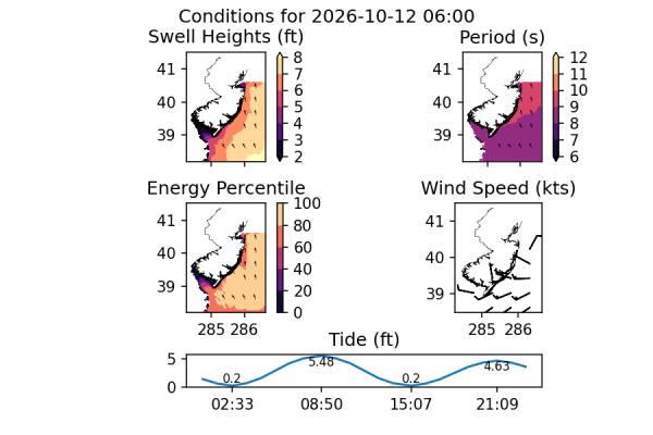
The peak of the swell should show 6 to 7 feet at around 9 second period. Solid waves with excellent shape assuming the wind goes offshore. This plot is showing an offshore wind, but I have my doubts at this time.
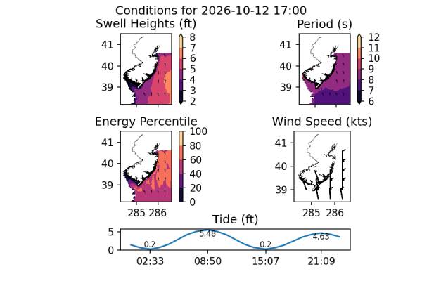
For the evening, there should be plenty of waves remaining and wind should be out of the northwest. Personally, I think this will end up being the best window of conditions for our region, but it’s still early to make that call.
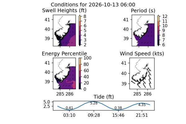
While there will be less surf on 10/13, I would expect leftovers based on what I’m seeing in the charts. Whether it’s chest high or waist high is going to be impossible to determine for a couple of days, but I would expect conditions that would allow a small wave performance board, at the least.
The Short Version
Sunday is likely to have inclement weather due to the remnants of hurricane Isaiah with strong ESE winds and some storm surge expected. Wind shifts out of the north for Monday with a possible side-offshore switch later in the day. Other regions will have better conditions during the peak of the swell (eg. NY and south NJ). Tuesday AM looks fun for the more average surfer with leftover surf in the waist+ range with some push and quality shape. Wind should be light offshore for glassy to slightly offshore conditions and will be fun and user friendly.
Looks fun y’all!