Hurricane Season?
One for the history books, folks…
The Peak of Hurricane Season
The statistical peak of hurricane season is today, 9/10. Historically (going back to 1851), there is a 74.3% chance of finding something in the Atlantic Basin. Below is the graphical tropical outlook for today:
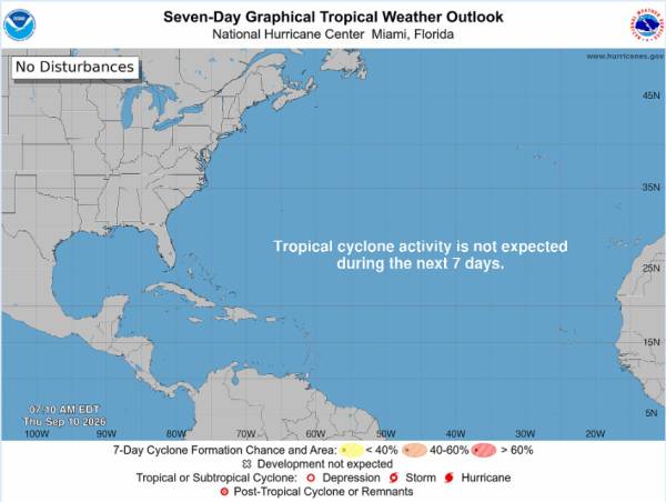
Source: NOAA National Hurricane Center
Well, I’ll be, there’s nothing there. While a 1 in 4 chance of nothing isn’t that crazy, the fact that there hasn’t been a hurricane is statistically quite a bit less likely. Since 1851, there have been two years with no hurricanes, 1907 and 1914. That’s 2 out of 175 years (or 1.14%)! Incredibly unlikely. Now, we’re not out of hurricane season yet and other years have been quiet before a seriously major storm (1992; Hurricane Andrew). But the fact that we’re here at the statistical peak with a quiet outlook and forecast, really shows the significance of the El Nino event we’re seeing right now.
The primary reason for the lack of cyclone development is the extraordinary strength of the El Nino event (69% chance of strongest event ever recorded). A strong El Nino increases wind shear through the Atlantic Basin and MDR and shreds any storm before it can strengthen.
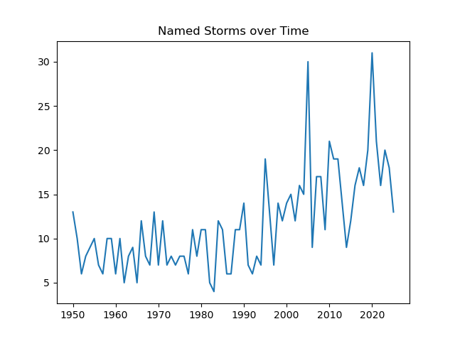
Even though we know the why, it’s still interesting to look at the data and how different this year is from the trend. Below is a chart of named storms over time (includes non-hurricane tropical storms):
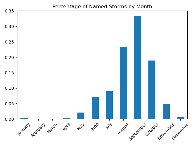
For good measure, let’s look at the percentage of storms by month:
Discussion and What Could Happen Next
Unsurprisingly, September is the most common month, followed by August and then closely by October. So, there is still plenty of time for a storm to form by historical standards. That said, El Nino conditions are expected to further strengthen through the rest of the year and the Climate Prediction Center is only giving a >20% chance for the last week of September.
From the Tropical Hazard Outlook dated 9/8, the main chance of TS development would be due to stronger than expected MJO propagation. The timing of this would be at/near the end of September (and why that 20% chance is given above). The majority of weather models are still suggesting that strong shear will continue. Essentially, if any storm is to form, it’s likely to be near the Gulf.
Data Source for the Above Analysis: NOAA HURDAT 2
Data Source for El Nino: NOAA NWS Climate Prediction Center El Nino Diagnostic Discussion