Weather Analysis for the Week of 6/1
High pressure dominates for most of the work week
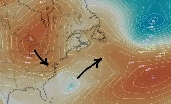
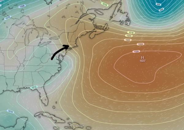
High pressure slides in to our region to start the work week. At the same time, we have a small area of low pressure that exits to the northeast. A small center of low pressure can just be seen off North Carolina that is expected to develop in strength through mid-week and could potentially offer some east swell to our region. I have fairly low expectations for quality/size at this time.
The strength of that high pressure system prevents/pushes away any low pressure system from reaching our swell window through mid-week.
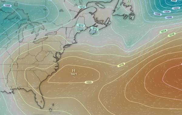
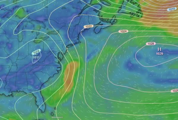
Moving into mid-week, high pressure is expected to exit off North Carolina before slowly working its way to the east. We’ll start to see some offshore wind flow around this time period.
The lion’s share of swell generated from the low pressure system discussed above will be headed to Florida. Hatteras island should pick up something with decent conditions likely. Florida is expected to remain onshore with poor conditions.
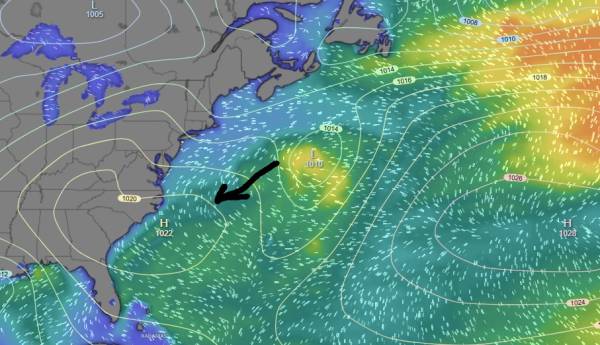
As we look to the weekend, we should start to see some southerly wind flow as high pressure continues to move further into the Atlantic. This allows for low pressure to move in over the Great Lakes and start to interact with high pressure over the Maritimes and western Atlantic. This pattern gives us trade like swell with imperfect wind and relatively soft/mushy surf. With some south wind protection, this can end up being pretty fun considering we’re approaching the summer months.
That low pressure system is expected to stall and move south which should keep the south wind flowing, but prevent any type of cleanup or wind switch.
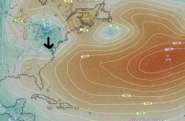
Low pressure from the SW should continue to press into high pressure parked over the western Atlantic. This is a better setup that should lead to a fun size swell. Stronger winds will develop between these areas of low and high pressure. See below:
We end up with a decent fetch of near gale winds that looks well enough directed towards our region. Looking at the swell chart below, waves are mainly directed to our east, but we’re still picking up a fair amount of it.
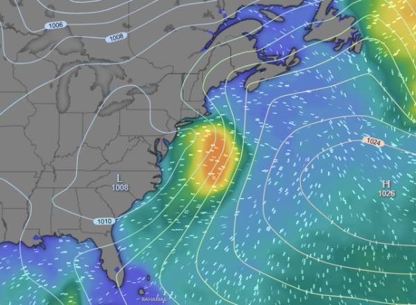
All in all, model outputs are in the 3+ft @ 8s give or take, which works really well with our current sandbars. While it’s stomach-chest high give or take, the shape should be really nice, which is a welcome change from this week’s NE swell.