Forecaster's Note for 5/29/26
Always nice to have waves going into June but it’s a challenging forecast
The Setup
We have a relatively weak low pressure system headed down over the Northeast and is expected to exit over Cape Cod before heading NE just south of the Canadian Maritimes. It’s not particularly well placed for us, but we should see some surf from this system with clean conditions from offshore winds due to a high pressure over the Great Lakes. Check out the chart below:
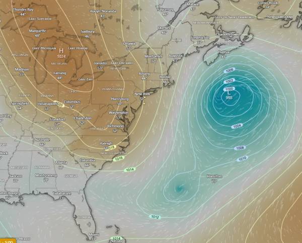
source: windy.com
Note the region between the high pressure over the Great Lakes and the Low pressure to it’s east. That’s primarily where the wind fetch will develop and waves will form in that corridor. North Carolina (Hatteras in particular) and eventually Florida will end up seeing the most swell from this system. Zooming in on New Jersey, we can see how the swell angle plays with our region:
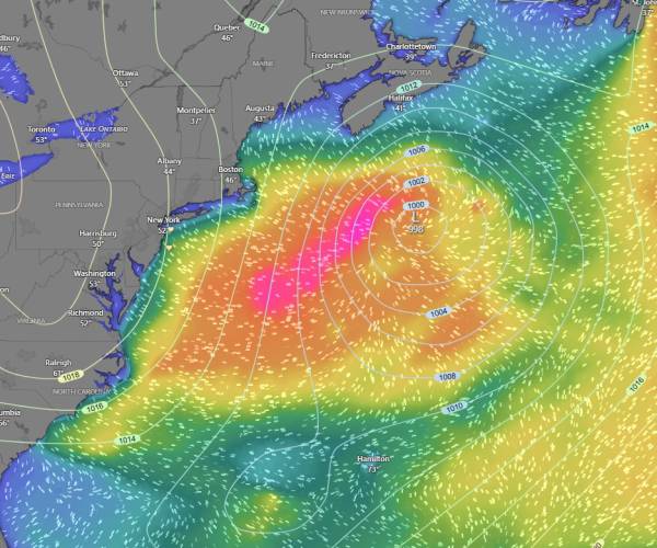
source: windy.com
As you can see, the swell is primarily aimed south and has an angle of roughly around 15-20 degrees from true north. Cape Cod blocks a fair amount of swell from this angle and Long Island doesn’t help. So, in this case we are looking at swell that has to wrap in. Luckily, we’re looking at mid-period swell of around 10 seconds which should help, but it’s far from ideal.
The Waves
While buoy height forecasts are going to look optimistic, it’s important to remember they are miles out in the ocean and therefore will pick up more of this north angled swell than our beaches will. This is a swell where an extra 20 minutes of drive time could play a huge role in the size waves you end up seeing.
We haven’t seen any steep north swells in a while. Keep that in mind when looking for sandbars. You’ll want to be looking for lefts.
The swell is expected to fade pretty fast through the day. If you are looking to surf north of Ocean County, I’d plan on getting on it first thing. You have a bit more time if you’re going to be around LBI.
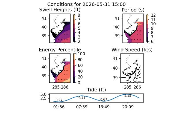
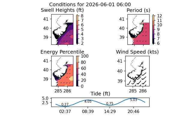
Check out the charts below (data source: NOAA NWPS and NOAA Tides and Currents):
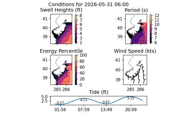
The early AM shows the most size, but you’ll want to watch out for the mid-AM high tide.
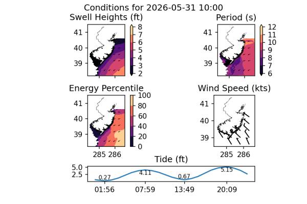
I’d avoid the high tide, but there should still be some waves around after the slack tide.
Surf fades significantly by evening.
Currently, the GFS model is predicting some reinforcing swell to show up late Sunday or early Monday. Personally, I’m not seeing this happen, but I’d keep an eye on it just in case.
Looking Ahead
There’s definitely activity on the charts, which is nice to see as we start to approach the summer months. High pressure likely dominates early week but we could see another low make it’s way into our swell window mid-late week. That would likely be another east swell, but given that it’s working it’s way north, there’s a better chance for a more favorable swell angle.
While it’s too far out for any confidence, the second week of June looks interesting. Models are showing high pressure camped out over the centeral Atlantic with multiple regions of low pressure moving across the mainland U.S. If any of those make it through and bump into that high pressure, we should see a favorable south swell. I’m optimistic about this setup!