Swell Event Notes
Will it be the best swell of the season?
First, The Setup
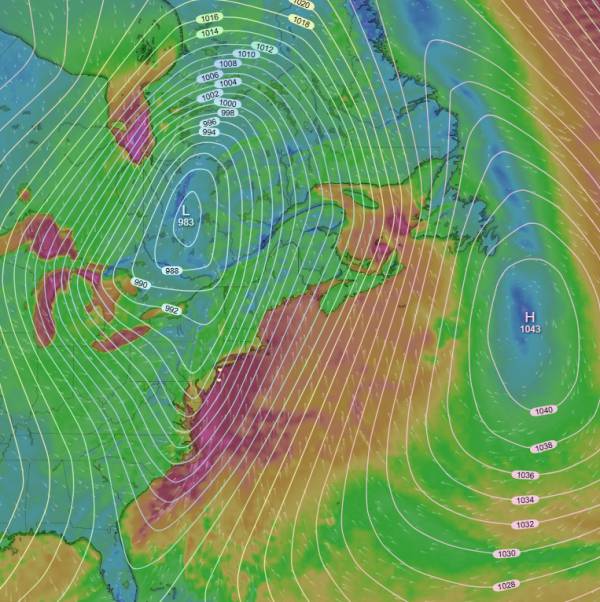
source: windy.com - ECMWF surface wind chart
We have a strong low pressure system tracking over the Great Lakes and interacting with a strong region of high pressure over the northwest Atlantic creating a moderate sized gale aimed at our region. This is a pretty ideal setup for us in terms of swell angle and resulting wave height/period and I’d expect it to play nicely with our sandbars.
Wind shifts offshore following the passage of this low pressure system (a strong cold front) but will be moderately strong. Conditions should clean up quick, but there will definitely be a bit more wind than would be ideal. Given the strong south swell, I’d expect a strong south current and a lot of water moving around.
The Waves
Largest sea heights are seen overnight at around 16-18ft offshore. The strong offshore wind switch knocks that down a good bit and buoy heights should be around 9ft for the AM with primary swell coming in around 7-8ft at a period of 10 seconds. The early morning high tide complicates things a bit, but there will be plenty of swell on the dropping tide and conditions should continue to get better.
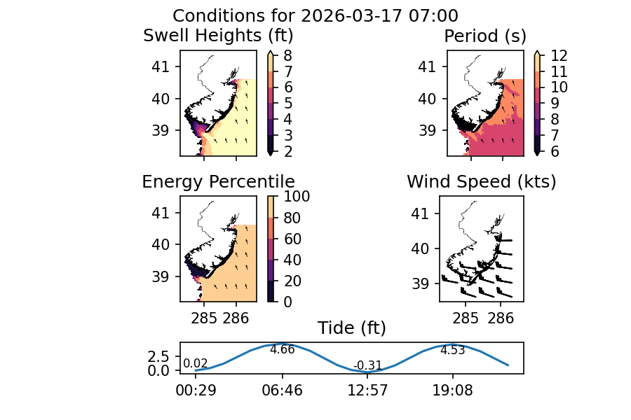
data source: NOAA NWPS - AM waves for Tuesday 3/17
Wind is completely offshore by the AM but we’re looking at 20+kts on the gusts with near 20kts sustained. Ocean County sees the largest wave heights but shape will be an issue given the size and swell direction. I’d expect Monmouth to handle this the best.
For the afternoon, I’d expect wave heights to be more manageable for the experienced but not expert surfer. We should be looking at closer to 5.5ft@10s and maybe a bit under that depending on how the wind interacts with the surf. Wind lessens some for the afternoon but is still near close to 20kts. It’s still a solid swell and less experienced surfers will need to use caution.
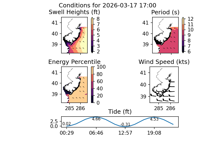
data source: NOAA NWPS - PM waves for Tuesday
The incoming tide in the afternoon will likely be the best overall conditions with the early evening window looking very good.
The Leftovers
The rest of the week looks interesting. Wednesday AM should still have plenty of swell but you’ll want to plan around the annoyingly timed high tide. 4.82 feet is too much water for the majority of breaks. Waves should be in the stomach high range in the 9-10 second period range. Wind is light offshore to side-offshore early before switching onshore for the afternoon.
The dawn patrol session would have the largest waves and best wind but first light is pretty close to high tide. I’d have low expectations for that time period. The dropping tide will likely have the best overall conditions but I’d avoid going too close to the also significant low tide. Overall, I’d expect a pretty small window of good conditions.
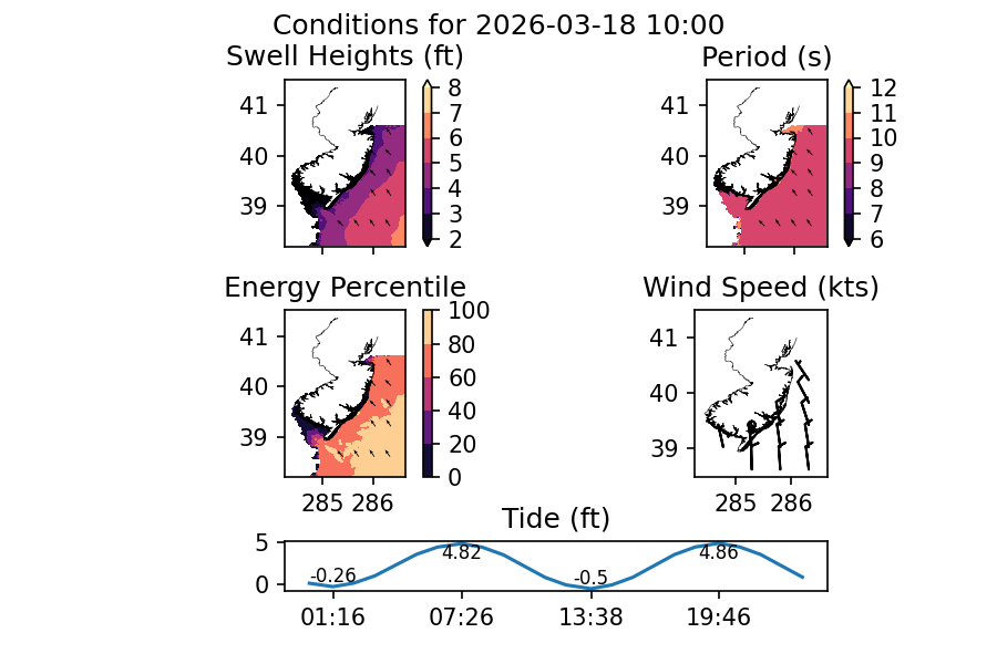
data source: NOAA NWPS - Late AM waves for Wednesday 3/18
Models are suggesting that leftovers extend into Thursday with waist-stomach high surf expected and light onshore wind. It’s a little far out, but should be fun if that forecast holds. Friday is a possibility but more for the longboards based on current charts. More swell is possible into the weekend and early the following week.