Monmouth County Surf Forecast
Last Update: 11/28/2025 10:15 (Next update will likely be 11/30)
Link to Free Surf Cams: Beach Cams
Scroll to the right for more information in the below tables
Next Three Days at a Glance
| Date | Wave Height | Wind Direction | Wind Speed | Energy Percentile |
|---|---|---|---|---|
| TODAY | Flat | W | 20 | 0 |
| TONIGHT | Flat | W | 25 | 8 |
| SAT | Flat | WNW | 15 | 0 |
| SAT NIGHT | Flat | W | 8 | 0 |
| SUN | Flat | S | 12 | 15.9 |
| SUN NIGHT | Knee | SSW | 17 | 44.7 |
We’ve had and will have disappointing surf for a while. Check back around 12/3. See my forecast note here for more information about the pattern we’ve been in and what could be in store early December.
Week of 11/23-11/30
After a couple of uneventful weeks, it seems that things are looking up a bit. I’m expecting a small, but potentially fun swell for 11/26 and then another swell for the first week of December. I’m hoping we see some leftovers for Thanksgiving day, but the wind forecast is going to play an outsized role in determining how much swell sticks around. Either way, it’ll be gone early. Low tide lines up well for dawn patrol.
Unfortunately, the swell for 11/26 is almost entirely from an area of high pressure in the Western Atlantic. Originally, it looked like we would see some interaction with a stronger area of low pressure over the Great Lakes, which would have strengthened the swell a bit, but that doesn’t seem like the case anymore. Either way, we have some surfable swell with light winds.
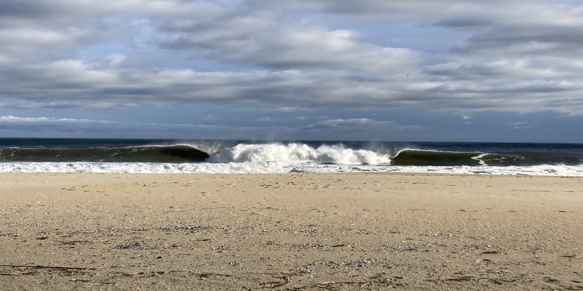
Friday 11/28 - Saturday 11/29
Flat. Winds will be strong offshore through Saturday afternoon with cold weather expected.
Sunday 11/30
| Time | Swell Height | Period | Wave Direction | Energy Percentile | Wind Speed | Wind Direction |
|---|---|---|---|---|---|---|
| 07:00 | 3 | 4 | 187 | 1.3 | 20.4 | SSW |
| 10:00 | 4.6 | 5 | 184.4 | 12.6 | 24.4 | SSW |
| 13:00 | 5.2 | 5.6 | 186 | 22.2 | 21.3 | SSW |
| 16:00 | 5.1 | 6.2 | 181.3 | 31.2 | 17.2 | WSW |
| 19:00 | 5.2 | 6.2 | 179.4 | 33.8 | 23.4 | WSW |
| Time | Tide | Height (ft) |
|---|---|---|
| 02:19 | H | 4.52 |
| 08:45 | L | 0.54 |
| 14:37 | H | 4.3 |
| 20:57 | L | -0.02 |
An area of low pressure moves through setting up steep angled windswell. This is a similar situation to what we saw Wednesday 11/26. More steep angled and weak windswell. I’m not expecting rideable surf from this. Wind stays crosshore most of the day.
Notes: Find southerly wind protection if looking to try and surf.
Looking Ahead
The first couple weeks of December are looking pretty active. It’s possible we’ll see back to back swells around 12/1 and 12/7. It’s pretty far out, but models have been pretty consistent about the first week of December. It does look like we’re finally seeing a change in the pattern from low pressure systems staying north over the Great Lakes. That pattern has led to us primarily seeing interaction with the far southwest corner of the windfield, which has been creating that SW swell we’ve been seeing (or not seeing). Hopefully that remains the case for a while.
There’s a lot of potential in the next couple of weeks. It’s worth watching almost every day from 12/3 - 12/10 with more potential after that.
Monday 12/01
| Time | Swell Height | Period | Wave Direction | Energy Percentile | Wind Speed | Wind Direction |
|---|---|---|---|---|---|---|
| 07:00 | 2.9 | 3.8 | 299.4 | 0 | 18.3 | NW |
| 10:00 | 2.8 | 3.9 | 328.6 | 0 | 17.8 | NNW |
| 13:00 | 2.1 | 3.7 | 341.6 | 0 | 12.8 | NNW |
| 16:00 | 1.5 | 7.4 | 121.8 | 16.2 | 7.6 | N |
| 19:00 | 1.1 | 7.2 | 120.5 | 8.2 | 1.1 | NNE |
| Time | Tide | Height (ft) |
|---|---|---|
| 03:13 | H | 4.91 |
| 09:45 | L | 0.17 |
| 15:43 | H | 4.38 |
| 21:51 | L | -0.27 |
Monday is expected to remain flat at this point.
Tuesday 12/02
| Time | Swell Height | Period | Wave Direction | Energy Percentile | Wind Speed | Wind Direction |
|---|---|---|---|---|---|---|
| 07:00 | 1.5 | 3.2 | 130.4 | 0.2 | 9.2 | ESE |
| 10:00 | 2.1 | 3.2 | 115.8 | 0.6 | 17.8 | ENE |
| 13:00 | 4.3 | 4.7 | 88.6 | 21.5 | 21.3 | ENE |
| 16:00 | 5.6 | 5.6 | 100 | 47.2 | 18.3 | NNE |
| 19:00 | 6.4 | 7.2 | 155 | 67.3 | 22.4 | N |
| Time | Tide | Height (ft) |
|---|---|---|
| 04:13 | H | 5.32 |
| 10:39 | L | -0.17 |
| 16:43 | H | 4.5 |
| 22:39 | L | -0.46 |
We should start ot see swell filtering in late day on Tuesday. Currently, I’m not expecting surfable waves on Tuesday.
Notes: Swell should start arriving for tomorrow.
Wednesday 12/03
| Time | Swell Height | Period | Wave Direction | Energy Percentile | Wind Speed | Wind Direction |
|---|---|---|---|---|---|---|
| 07:00 | 5.5 | 9.5 | 146.8 | 84.5 | 20.8 | NW |
| 10:00 | 4.8 | 9.2 | 149 | 76.8 | 17.3 | NW |
| 13:00 | 3.9 | 9 | 149.6 | 67 | 13.6 | NW |
| 16:00 | 3.3 | 8.8 | 148.3 | 58 | 12.4 | NW |
| 19:00 | 2.8 | 8.5 | 146.2 | 48.3 | 10.3 | WNW |
| Time | Tide | Height (ft) |
|---|---|---|
| 05:07 | H | 5.66 |
| 11:33 | L | -0.44 |
| 17:37 | H | 4.62 |
| 23:33 | L | -0.57 |
Here’s hoping this is what we end up seeing. A coastal low pressure system lifts up the coast and interacts with a high pressure system over the central Atlantic setting up some short-mid period swell. Currently, I believe chest high surf is a reasonable estimate but we could see larger sets in the morning. Wind is side-offshore for mostly clean conditions. We have a mid-day low tide but a pretty large tide swing. Timing will be important. The swell direction is favorable. Conditions will get cleaner as the day goes on, with cleanest conditions near end of day.
Notes: The best swell I’ve seen on the forecast for quite some time. Wind isn’t perfect, but it’ll definitely be doable. Largest waves in the AM, but there should be enough swell all day for fun surf. We have a 6’ tide swing, so aim for the mid-tide. Low tide will be too low and high tide too high, so keep that in mind. It’s looking really fun with a particularly favorable swell direction. Make sure to find a sandbar that is working to make the most of it.
Best board for today: Daily driver for the AM and a groveler after mid-day.
Thursday 12/4
| Time | Swell Height | Period | Wave Direction | Energy Percentile | Wind Speed | Wind Direction |
|---|---|---|---|---|---|---|
| 07:00 | 2.6 | 7.9 | 140.7 | 38.8 | 14.7 | W |
| 10:00 | 2.6 | 7.8 | 139.1 | 38.4 | 14.5 | W |
| 13:00 | 2.6 | 7.6 | 144.6 | 35.4 | 15.1 | W |
| 16:00 | 2.8 | 7.5 | 144.5 | 37.5 | 17.4 | WNW |
| 19:00 | 2.9 | 3.5 | 281.6 | 0 | 18.6 | WNW |
| Time | Tide | Height (ft) |
|---|---|---|
| 06:01 | H | 5.86 |
| 12:33 | L | -0.62 |
| 18:31 | H | 4.68 |
It looks like we’ll have a little bit of leftover swell for Thursday morning. It’s pretty far out, but if this holds, I’d expect thigh-waist high surf with good shape.
Notes: Pretty far out. Check back later
Best board: Probably a longboard.
Late Week into the Weekend
Too far out to forecast, but there’s a pretty complicated set up with multiple low pressure systems moving around our area. It’s a time period to watch and there is likely to be some swell. Overall, things are looking up relative to the month we just went through.
Beach Cams (links to thesurfersview.com) Beach Cams
Current list of Surf Hazards Surf Hazards
Why Energy Percentile? Energy Article